6 August 2005
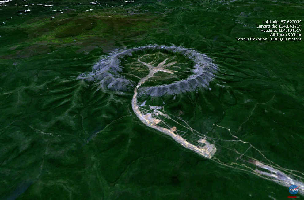
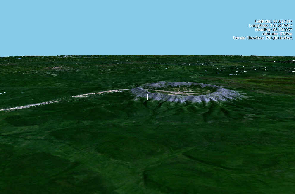
Cryptome asked for information on this strange-looking site Google-spotted in southeastern Russia:
http://maps.google.com/maps?ll=57.599439,134.634018&spn=0.249564,0.600128&t=h&hl=en
A1 writes:
I noticed Google Maps had the lattitude and longtitude in the URL, which made the location easy to find with NASA's worldwind (http://worldwind.arc.nasa.gov/), which I prefer to Google. Seems like some sort of volcano/crater.
|
|
A2 writes:
Just a quick comment on the recent Cryptome posting. That pic is of an old Russia volcano, most likely Ipelka but possibly a couple others. The thin ribbon leaving on one side is the lava flow, and the red field on the opposite side is possibly the debris field after an eruption.
http://volcano.und.edu/vwdocs/volc_images/north_asia/kamchatka/ipelka.html
A3 writes:
With reference to "Russia-what?," to the best of my knowledge the image appears to be an open cast mine, possibly, and perhaps a gold mine. The Dzhugdzhur mountain range has quite a few workings since the 1920's.
Cryptome:
The last suggestion would account for the regular-circle shape of material, quite different from irregularly-shaped volcanic debris. This ring of debris could be overburden or tailings from a mine operation. The stream would then be the liquid-borne outtailings which are transmitted to the striated settling fields downstream for harvesting of mine residue produced by high-pressure water jet or repetitive washing, especially productive for recovering the maximum amount of valuable metals.